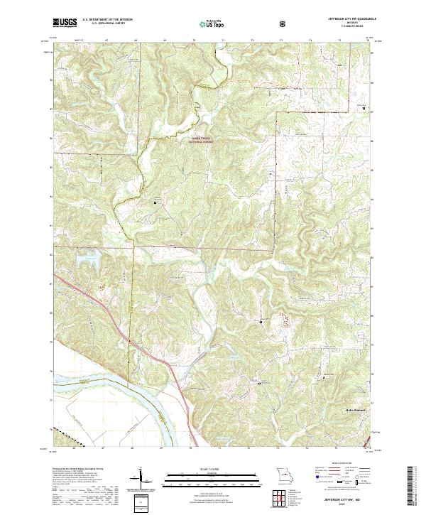
2021 Map of Jefferson City NW
USGS Topo · Published 2021About this map
The Missouri River and its northern tributaries define this landscape along the border of Boone and Callaway counties. Just north of the river, the Katy Trl follows the historical rail corridor, passing through the base of Harrisons Hill and beneath the bluffs near Demarco Lake. The topography is dominated by the deeply incised drainages of Cedar Creek, Brushy Cr, and Clifton Cr, which carve through the dense timber of the Mark Twain National Forest.
Find a feature on this map
78 named features on this map. Tap any name to fly to it.
Don’t see what you’re looking for? This feature index may not catch every label — zoom into the map to look around manually.
Map Details
Editions of this 2021 Jefferson City NW Map
This is the sole edition of this map. No revisions or reprints were ever made.
Other maps of this area

1886 · Jefferson City
USGS Topo · 1:125,000

1894 · Jefferson City
USGS Topo · 1:125,000

1939 · Jefferson City
USGS Topo · 1:24,000

1939 · Jefferson City
USGS Topo · 1:62,500

1942 · Jefferson City
USGS Topo · 1:62,500

1944 · Millersburg
USGS Topo · 1:62,500

1946 · Millersburg
USGS Topo · 1:62,500

1947 · Jefferson City
USGS Topo · 1:250,000

1948 · Centertown
USGS Topo · 1:62,500

1948 · Columbia
USGS Topo · 1:62,500