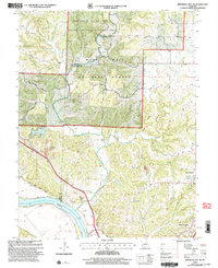
2000 Map of Jefferson City NW
USGS Topo · Published 2003About this map
Cedar Creek forms a winding natural border between Boone and Callaway counties, cutting through the heart of the Mark Twain National Forest. The landscape here at the turn of the millennium is a complex mix of conservation land, such as the Baskett Wildlife Research Area managed by the University of Missouri, and industrial activity marked by several Quarries near the river bluffs. Along the southern edge, the Missouri River is flanked by an extensive system of levees, protecting the low-lying State Prison Farm from the shifting currents of the floodplain.
Find a feature on this map
40 named features on this map. Tap any name to fly to it.
Don’t see what you’re looking for? This feature index may not catch every label — zoom into the map to look around manually.
Map Details
Editions of this 2000 Jefferson City NW Map
This is the sole edition of this map. No revisions or reprints were ever made.
Other maps of this area

1886 · Jefferson City
USGS Topo · 1:125,000

1894 · Jefferson City
USGS Topo · 1:125,000

1939 · Jefferson City
USGS Topo · 1:24,000

1939 · Jefferson City
USGS Topo · 1:62,500

1942 · Jefferson City
USGS Topo · 1:62,500

1944 · Millersburg
USGS Topo · 1:62,500

1946 · Millersburg
USGS Topo · 1:62,500

1947 · Jefferson City
USGS Topo · 1:250,000

1948 · Centertown
USGS Topo · 1:62,500

1948 · Columbia
USGS Topo · 1:62,500