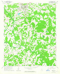
1964 Map of Jefferson
USGS Topo · Published 1965About this map
Jefferson serves as the primary hub of activity in this mid-century survey, situated at the junction of the Seaboard Air Line and several key roadways. The landscape is deeply tied to the movement of water, defined by the winding course of the Middle Oconee River and the Mulberry River, which establish the natural drainage patterns across the Jackson and Barrow county line. Infrastructure for the growing municipality is evident in the Filtration Plant and Settling Basin located north of the city center.
Find a feature on this map
35 named features on this map. Tap any name to fly to it.
Don’t see what you’re looking for? This feature index may not catch every label — zoom into the map to look around manually.
Map Details
Editions of this 1964 Jefferson Map
This is the sole edition of this map. No revisions or reprints were ever made.
Other maps of this area

1891 · Gainesville
USGS Topo · 1:125,000

1891 · Carnesville
USGS Topo · 1:125,000

1896 · Monroe
USGS Topo · 1:125,000

1953 · Athens
USGS Topo · 1:250,000

1954 · Greenville
USGS Topo · 1:250,000

1958 · Greenville
USGS Topo · 1:250,000

1958 · Athens
USGS Topo · 1:250,000

1959 · Athens
USGS Topo · 1:250,000

1963 · Athens
USGS Topo · 1:250,000

1964 · Commerce
USGS Topo · 1:24,000