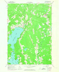
1965 Map of Jefferson
USGS Topo · Published 1974About this map
The expansive Damariscotta Lake dominates this mid-1960s survey of Lincoln County, stretching through the western half of the quadrangle from Great Bay south through The Narrows. This coastal Maine landscape is defined by its series of small, dispersed hamlets often centered on road intersections, including Stickney Corner, Kennedy Corner, and Orffs Corner. To the east, the Medomak River winds southward past North Waldoboro, interrupted by several Rapids that historically shaped the local timber and milling economy.
Find a feature on this map
47 named features on this map. Tap any name to fly to it.
Don’t see what you’re looking for? This feature index may not catch every label — zoom into the map to look around manually.
Map Details
Editions of this 1965 Jefferson Map
4 editions found
Other maps of this area

1893 · Vassalboro
USGS Topo · 1:62,500

1893 · Wiscasset
USGS Topo · 1:62,500

1898 · Vassalboro
USGS Topo · 1:62,500

1913 · Waldoboro
USGS Topo · 1:48,000

1915 · Waldoboro
USGS Topo · 1:62,500

1916 · Liberty
USGS Topo · 1:62,500

1941 · Waldoboro
USGS Topo · 1:62,500

1941 · Vassalboro
USGS Topo · 1:62,500

1942 · Liberty
USGS Topo · 1:62,500

1943 · Vassalboro
USGS Topo · 1:62,500