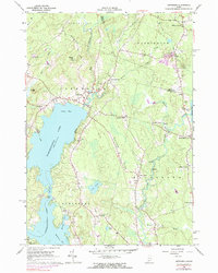
1965 Map of Jefferson
USGS Topo · Published 1983About this map
Damariscotta Lake dominates this mid-century view of the Lincoln County interior, where the waters of Great Bay meet The Narrows near the settlement of Jefferson. The landscape is defined by its many crossroads hamlets and the meandering course of the Medomak River as it flows south toward North Waldoboro. Small family cemeteries and local landmarks like the St Giles Ch and the Lookout Tower on Haskell Hill suggest a long-established rural community organized around the timber and water resources of the region.
Find a feature on this map
47 named features on this map. Tap any name to fly to it.
Don’t see what you’re looking for? This feature index may not catch every label — zoom into the map to look around manually.
Map Details
Editions of this 1965 Jefferson Map
4 editions found
Other maps of this area

1893 · Vassalboro
USGS Topo · 1:62,500

1893 · Wiscasset
USGS Topo · 1:62,500

1898 · Vassalboro
USGS Topo · 1:62,500

1913 · Waldoboro
USGS Topo · 1:48,000

1915 · Waldoboro
USGS Topo · 1:62,500

1916 · Liberty
USGS Topo · 1:62,500

1941 · Waldoboro
USGS Topo · 1:62,500

1941 · Vassalboro
USGS Topo · 1:62,500

1942 · Liberty
USGS Topo · 1:62,500

1943 · Vassalboro
USGS Topo · 1:62,500