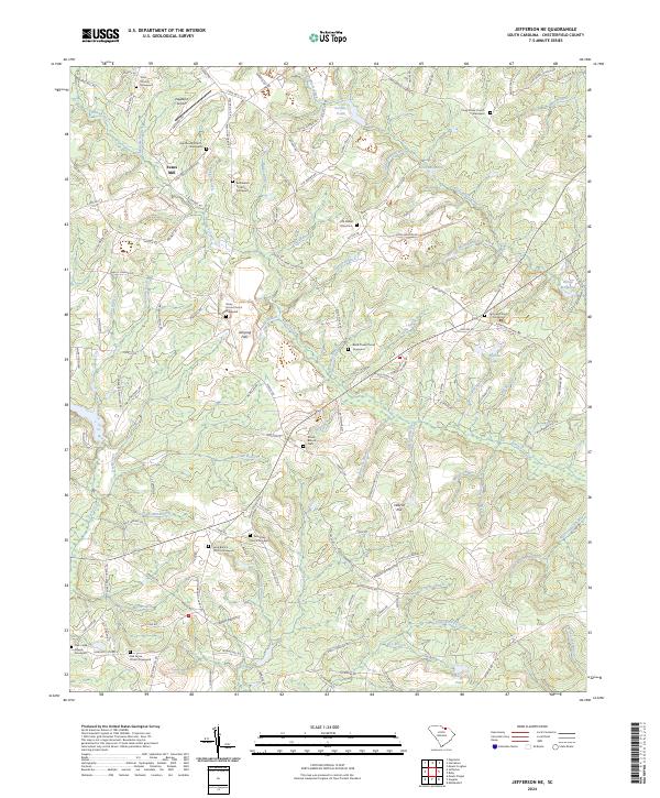
2024 Map of Jefferson NE
USGS Topo · Published 2024About this map
Black Creek and its many tributaries, including Mangum Branch and Little Black Creek, define the drainage of this portion of Chesterfield County. The landscape is dotted with numerous rural houses of worship and small cemeteries, such as Nicey Grove Church, Bethlehem Church, and Old Mount Olive Cem, providing valuable points of reference for local family history and genealogy. To the southeast, the terrain shifts into the protected woodland of the Carolina Sandhills National Wildlife Refuge, where the Joplin Branch and Dismal Spring Branch flow through a more densely vegetated environment. Aviation and light industry are represented by Pageland Airport and the vicinity of Evans Mill, showing the mix of agricultural heritage and modern utility in this rural South Carolina landscape.
Find a feature on this map
142 named features on this map. Tap any name to fly to it.
Don’t see what you’re looking for? This feature index may not catch every label — zoom into the map to look around manually.
Map Details
Editions of this 2024 Jefferson NE Map
This is the sole edition of this map. No revisions or reprints were ever made.
Other maps of this area

1941 · Spartanburg
USGS Topo · 1:250,000

1953 · Spartanburg
USGS Topo · 1:250,000

1960 · Spartanburg
USGS Topo · 1:250,000

1963 · Spartanburg
USGS Topo · 1:250,000

1964 · Spartanburg
USGS Topo · 1:250,000

1967 · Angelus
USGS Topo · 1:24,000

1967 · Mount Pisgah
USGS Topo · 1:24,000

1968 · Middendorf
USGS Topo · 1:24,000

1968 · Ruby
USGS Topo · 1:24,000

1968 · Jefferson
USGS Topo · 1:24,000