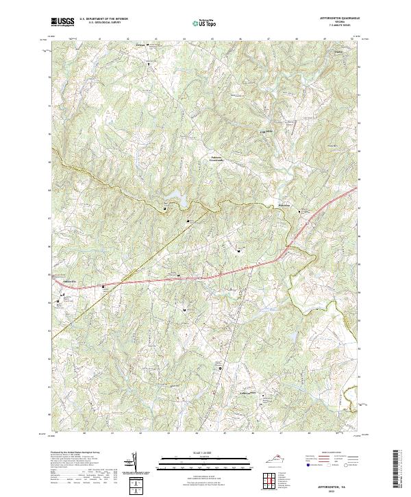
2022 Map of Jeffersonton
USGS Topo · Published 2022About this map
The Rappahannock River serves as the primary geographic and political boundary in this Virginia Piedmont landscape, separating Fauquier from Culpeper and Rappahannock counties. Settlements like Amissville and Jeffersonton anchor the road networks, while smaller hamlets such as Cliff Mills and Waterloo suggest earlier industrial or crossing points along the waterways. The area is dense with family history, marked by numerous small burial grounds including the Ney Family Graveyard and Burk - Shaw Family Cem.
Find a feature on this map
163 named features on this map. Tap any name to fly to it.
Don’t see what you’re looking for? This feature index may not catch every label — zoom into the map to look around manually.
Map Details
Editions of this 2022 Jeffersonton Map
This is the sole edition of this map. No revisions or reprints were ever made.
Other maps of this area

1893 · Luray
USGS Topo · 1:125,000

1894 · Warrenton
USGS Topo · 1:125,000

1894 · Warrenton
USGS Topo · 1:62,500

1905 · Luray
USGS Topo · 1:125,000

1927 · Remington
USGS Topo · 1:48,000

1930 · Warrenton
USGS Topo · 1:62,500

1939 · Front Royal
USGS Topo · 1:48,000

1943 · Orlean
USGS Topo · 1:24,000

1943 · Marshall
USGS Topo · 1:24,000
1944 · Marshall
USGS Topo · 1:31,680