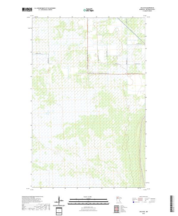
2022 Map of Jelle NE
USGS Topo · Published 2022About this map
Extensive wetland environments and organized section lines characterize this portion of Beltrami County, highlighting a landscape defined by drainage and access. The Fourtown-Grygla Trail System Trl cuts a distinct path through the terrain, serving as a primary corridor through the marshy lowlands. This area is structured by a grid of rural routes including Thorhult Rd NW and Loberg Rd NW, which provide access to the remote townships of t155n r37w and t155n r36w. The concentration of named roads such as Korstad Rd NW and Tresselt Rd NW in the northern sections suggests a more developed pattern of land use or habitation compared to the southern reaches of the quadrangle. This map documents a specialized northern landscape where transportation is strictly tied to the engineered township and range system.
Find a feature on this map
14 named features on this map. Tap any name to fly to it.
Don’t see what you’re looking for? This feature index may not catch every label — zoom into the map to look around manually.
Map Details
Editions of this 2022 Jelle NE Map
This is the sole edition of this map. No revisions or reprints were ever made.
Other maps of this area

1918 · F
USGS Topo · 1:62,500

1918 · Malcolm
USGS Topo · 1:62,500

1918 · Jelle
USGS Topo · 1:62,500

1954 · Roseau
USGS Topo · 1:250,000

1957 · Roseau
USGS Topo · 1:250,000

1958 · Roseau
USGS Topo · 1:250,000

1973 · Mosquito Creek
USGS Topo · 1:24,000
1973 · Cahill Lake
USGS Topo · 1:24,000

1973 · Jelle NE
USGS Topo · 1:24,000

1973 · Thorhult
USGS Topo · 1:24,000