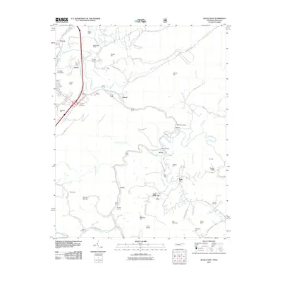
2011 Map of Jellico East
USGS Topo · Published 2011About this map
Clear Fork and its tributaries carve through this borderland region where Tennessee meets Kentucky, shaping a landscape defined by coal extraction and narrow hollows. The presence of several active or identified sites like the Blue Rose Mine, Carl Duncan Mine, and Brooks Graham Mine highlights the area's deep industrial ties. Small settlements such as Red Ash, Highcliff, and Chaska are connected by winding mountain roads like Stinking Creek Rd and Doc Siler Rd, revealing a settlement pattern closely following the creek beds. Cultural history is anchored by numerous family and community burial grounds, including Perkins Cemetery, Bowin Cemetery, and Chadwell Cemetery. Landmarks like the Morley Post Office and Heckler Knob provide fixed points for local genealogy and land-use studies in this mining-centered corridor.
Find a feature on this map
78 named features on this map. Tap any name to fly to it.
Don’t see what you’re looking for? This feature index may not catch every label — zoom into the map to look around manually.
Map Details
Editions of this 2011 Jellico East Map
This is the sole edition of this map. No revisions or reprints were ever made.
Other maps of this area

1886 · Cumberland Gap
USGS Topo · 1:125,000

1888 · Cumberland Gap
USGS Topo · 1:125,000

1890 · Williamsburg
USGS Topo · 1:125,000

1891 · Cumberland Gap
USGS Topo · 1:125,000

1893 · Briceville
USGS Topo · 1:125,000

1894 · Williamsburg
USGS Topo · 1:125,000

1895 · Briceville
USGS Topo · 1:125,000

1896 · Briceville
USGS Topo · 1:125,000

1897 · Maynardville
USGS Topo · 1:125,000

1900 · Maynardville
USGS Topo · 1:125,000