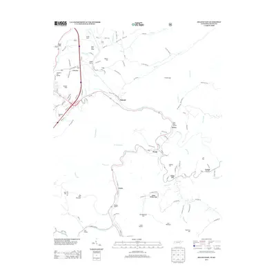
2013 Map of Jellico East
USGS Topo · Published 2013About this map
Highcliff and the surrounding mountain settlements of Campbell County sit along the winding corridor of the Clear Fork river in this 2013 survey. The landscape is defined by its dramatic relief, with steep-sided hollows like Slaughter Pen Hollow and York Hollow tucked between prominent elevations such as Big Four Mountain and Rich Mountain. This area has long been shaped by its coal mining and timber geography, evidenced here by the clusters of small communities like Red Ash, Morley, and Chaska that follow the valley floors and narrow gap passes.
Find a feature on this map
107 named features on this map. Tap any name to fly to it.
Don’t see what you’re looking for? This feature index may not catch every label — zoom into the map to look around manually.
Map Details
Editions of this 2013 Jellico East Map
This is the sole edition of this map. No revisions or reprints were ever made.
Other maps of this area

1886 · Cumberland Gap
USGS Topo · 1:125,000

1888 · Cumberland Gap
USGS Topo · 1:125,000

1890 · Williamsburg
USGS Topo · 1:125,000

1891 · Cumberland Gap
USGS Topo · 1:125,000

1893 · Briceville
USGS Topo · 1:125,000

1894 · Williamsburg
USGS Topo · 1:125,000

1895 · Briceville
USGS Topo · 1:125,000

1896 · Briceville
USGS Topo · 1:125,000

1897 · Maynardville
USGS Topo · 1:125,000

1900 · Maynardville
USGS Topo · 1:125,000