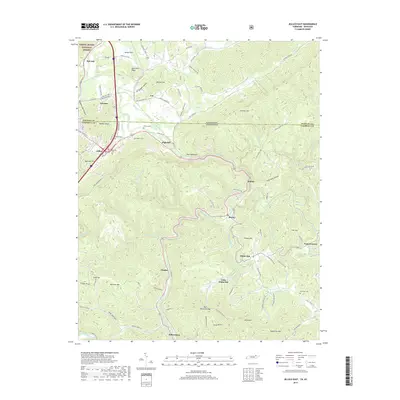
2019 Map of Jellico East
USGS Topo · Published 2019About this map
Jellico sits at the northern edge of this Campbell County survey, where the valley terrain meets the Kentucky Tennessee state line. The landscape is defined by the prominent ridge of Pine Mountain, which cuts diagonally across the center, influencing the development of mountain gaps and valley settlements. To the north, the Daniel Boone National Forest begins near Red Ash, while the southern reaches of the map show established mountain communities like Habersham and Chaska.
Find a feature on this map
99 named features on this map. Tap any name to fly to it.
Don’t see what you’re looking for? This feature index may not catch every label — zoom into the map to look around manually.
Map Details
Editions of this 2019 Jellico East Map
This is the sole edition of this map. No revisions or reprints were ever made.
Other maps of this area

1886 · Cumberland Gap
USGS Topo · 1:125,000

1888 · Cumberland Gap
USGS Topo · 1:125,000

1890 · Williamsburg
USGS Topo · 1:125,000

1891 · Cumberland Gap
USGS Topo · 1:125,000

1893 · Briceville
USGS Topo · 1:125,000
1894 · Williamsburg
USGS Topo · 1:125,000

1895 · Briceville
USGS Topo · 1:125,000

1896 · Briceville
USGS Topo · 1:125,000

1897 · Maynardville
USGS Topo · 1:125,000

1900 · Maynardville
USGS Topo · 1:125,000