
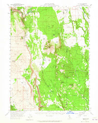
1957 Map of Jellico
USGS Topo · Published 1959About this map
Volcanic geology dominates the borderlands of Shasta and Lassen counties, where the massive Hat Creek Rim and Negro Camp Rim drop away into expansive lava fields. This 1957 field-checked survey reveals a landscape of high-altitude ranching and timber management within the Lassen National Forest. Small settlements and seasonal outposts like Jellico and Halls Flat anchor the eastern side of the quadrangle, while family-held land such as the Eldridge Ranch, Burton Ranch, and Bidwell Ranch dot the more habitable pockets of terrain.
Find a feature on this map
57 named features on this map. Tap any name to fly to it.
Don’t see what you’re looking for? This feature index may not catch every label — zoom into the map to look around manually.
Map Details
Editions of this 1957 Jellico Map
3 editions found
Other maps of this area

1886 · Lassen Peak
USGS Topo · 1:250,000

1886 · Modoc Lava Bed
USGS Topo · 1:250,000

1892 · Modoc Lava-Bed
USGS Topo · 1:250,000

1892 · Lassen Peak
USGS Topo · 1:250,000

1894 · Lassen Peak
USGS Topo · 1:250,000

1932 · Bartle
USGS Topo · 1:96,000

1935 · Burney
USGS Topo · 1:96,000

1939 · Burney
USGS Topo · 1:125,000

1939 · Halls Flat
USGS Topo · 1:125,000

1939 · Bartle
USGS Topo · 1:125,000