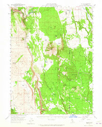
1957 Map of Jellico
USGS Topo · Published 1965About this map
The Hat Creek Rim and the Pit River dominate this mid-century landscape in the northern reaches of the Lassen National Forest. This 1957 survey documents a transition between volcanic geology and pastoral activity, characterized by the presence of Lava flows alongside remote outposts like Jellico and the St John Ranch. The terrain is marked by distinctive geological features including Cinder Cone, Popcorn Cave, and Big Cave, illustrating the region's active volcanic history.
Find a feature on this map
52 named features on this map. Tap any name to fly to it.
Don’t see what you’re looking for? This feature index may not catch every label — zoom into the map to look around manually.
Map Details
Editions of this 1957 Jellico Map
3 editions found

Other maps of this area

1886 · Lassen Peak
USGS Topo · 1:250,000

1886 · Modoc Lava Bed
USGS Topo · 1:250,000

1892 · Modoc Lava-Bed
USGS Topo · 1:250,000

1892 · Lassen Peak
USGS Topo · 1:250,000

1894 · Lassen Peak
USGS Topo · 1:250,000

1932 · Bartle
USGS Topo · 1:96,000

1935 · Burney
USGS Topo · 1:96,000

1939 · Burney
USGS Topo · 1:125,000

1939 · Halls Flat
USGS Topo · 1:125,000

1939 · Bartle
USGS Topo · 1:125,000