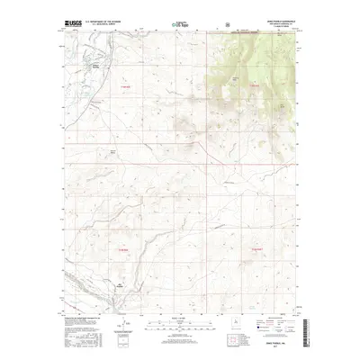
2017 Map of Jemez Pueblo
USGS Topo · Published 2017About this map
Jemez Pueblo and Zia Pueblo anchor this high-desert landscape in Sandoval County, illustrating the enduring settlement patterns along the Jemez River. The map details a complex network of traditional water management features, including the Zia S Side Canal, W Side Canal, and Anthony Recos Ditch, which support the agricultural life of the pueblos. These irrigation systems are contrasted by the sharp rise of the surrounding terrain, where the Santa Fe National Forest encompasses elevated landforms such as Chamisa Mesa and Borrego Mesa.
Find a feature on this map
42 named features on this map. Tap any name to fly to it.
Don’t see what you’re looking for? This feature index may not catch every label — zoom into the map to look around manually.
Map Details
Editions of this 2017 Jemez Pueblo Map
This is the sole edition of this map. No revisions or reprints were ever made.
Other maps of this area

1888 · Bernalillo
USGS Topo · 1:125,000

1889 · Albuquerque
USGS Topo · 1:125,000

1890 · Jemes
USGS Topo · 1:125,000

1892 · Jemes
USGS Topo · 1:125,000

1893 · Albuquerque
USGS Topo · 1:125,000

1939 · San Ysidro
USGS Topo · 1:62,500

1943 · San Ysidro
USGS Topo · 1:62,500

1943 · Jemez
USGS Topo · 1:62,500

1952 · Jemez
USGS Topo · 1:62,500

1953 · Bernalillo NW
USGS Topo · 1:24,000