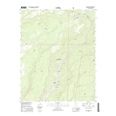
2017 Map of Jemez Springs
USGS Topo · Published 2017About this map
Jemez Springs and La Cueva serve as the primary hubs in this mountainous region of the Santa Fe National Forest. The geography is defined by high tablelands like Virgin Mesa and Stable Mesa, deeply carved by the Jemez River and its numerous tributaries. Geologic features are prominent throughout the canyon, most notably the Soda Dam, where mineral springs have created a unique natural formation. Hydrology is a central theme of the landscape, with thermal features such as Jemez Hot Springs Original Springs and Spence Hot Spring drawing interest to the canyon floor. Local history is anchored by landmarks like the Jemez Springs Catholic Cem and topographic identifiers such as Schoolhouse Mesa and Church Canyon, reflecting the enduring footprint of settlement within the Cañon de San Diego.
Find a feature on this map
55 named features on this map. Tap any name to fly to it.
Don’t see what you’re looking for? This feature index may not catch every label — zoom into the map to look around manually.
Map Details
Editions of this 2017 Jemez Springs Map
This is the sole edition of this map. No revisions or reprints were ever made.
Other maps of this area

1890 · Jemes
USGS Topo · 1:125,000

1892 · Jemes
USGS Topo · 1:125,000

1937 · Jemez Springs
USGS Topo · 1:48,000

1939 · La Ventana
USGS Topo · 1:62,500

1939 · San Ysidro
USGS Topo · 1:62,500

1943 · San Ysidro
USGS Topo · 1:62,500

1943 · Jemez
USGS Topo · 1:62,500

1943 · La Ventana
USGS Topo · 1:62,500

1944 · Jemez Springs
USGS Topo · 1:62,500

1952 · Jemez Springs
USGS Topo · 1:62,500