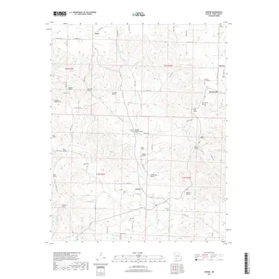
2017 Map of Jenkins
USGS Topo · Published 2017About this map
Jenkins and the surrounding Barry County landscape are defined by a complex network of hollows and spring-fed creeks. The topography is deeply incised, with Flat Creek and Jenkins Creek serving as the primary drainage for numerous smaller tributaries like Coon Creek and Brantley Branch. This area is dotted with small, dispersed settlements including Wheelerville, Madry, and Leann, many of which grew near reliable water sources such as Roaring Spring and Upshaw Spring.
Find a feature on this map
85 named features on this map. Tap any name to fly to it.
Don’t see what you’re looking for? This feature index may not catch every label — zoom into the map to look around manually.
Map Details
Editions of this 2017 Jenkins Map
This is the sole edition of this map. No revisions or reprints were ever made.
Other maps of this area

1927 · Shell Knob
USGS Topo · 1:62,500

1937 · Cassville
USGS Topo · 1:48,000

1942 · Aurora
USGS Topo · 1:62,500

1943 · Monett
USGS Topo · 1:62,500

1944 · Cassville
USGS Topo · 1:62,500

1945 · Harrison
USGS Topo · 1:250,000

1945 · Aurora
USGS Topo · 1:62,500

1949 · Harrison
USGS Topo · 1:250,000

1950 · Shell Knob
USGS Topo · 1:62,500

1954 · Harrison
USGS Topo · 1:250,000