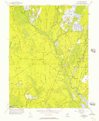
1956 Map of Jenkins
USGS Topo · Published 1957About this map
The West Branch of the Wading River and its numerous Cranberry Bogs define this portion of the New Jersey Pine Barrens during the mid-1950s. The landscape is marked by small, isolated settlements such as Jenkins and Harrisville, the latter featuring Ruins and a Gaging Station near Harrisville Pond. Cultural history is evident in the naming of topographical features like Jemima Mount and Stormy Hill, alongside family-named roads like Sooy Road and Hawkins Road.
Find a feature on this map
69 named features on this map. Tap any name to fly to it.
Don’t see what you’re looking for? This feature index may not catch every label — zoom into the map to look around manually.
Map Details
Editions of this 1956 Jenkins Map
3 editions found
Other maps of this area

1884 · Whitings
USGS Topo · 1:62,500

1888 · Pemberton
USGS Topo · 1:62,500

1888 · Little Egg Harbor
USGS Topo · 1:62,500

1888 · Whitings
USGS Topo · 1:62,500

1890 · Mullica
USGS Topo · 1:62,500

1893 · Little Egg Harbor
USGS Topo · 1:62,500

1894 · Pemberton
USGS Topo · 1:62,500

1894 · Mullica
USGS Topo · 1:62,500

1898 · Pemberton
USGS Topo · 1:62,500

1898 · Mullica
USGS Topo · 1:62,500
Featured Places
- Tabernacle Township, NJ
- Mullica Township, NJ
- Bass River Township, NJ
- Washington Township, NJ
- Crowleytown, Washington Township