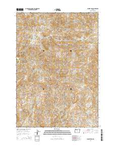
2014 Map of Jennies Peak
USGS Topo · Published 2014About this map
Jennies Peak stands as the primary landmark in this corner of the High Desert where the boundaries of Wasco and Wheeler counties meet. The landscape is defined by a series of dramatic volcanic and erosional features, including Sheep Mtn in the northwest and the distinctive Coffin Rock and Coyote Mtn to the south. Water sources are scarce but critical in this arid terrain, marked by Nicholson Spring and Sand Spring, which likely served as vital stopovers for ranching operations. The topography is deeply incised by complex drainage systems such as Jennies Peak Canyon, Rattlesnake Canyon, and Dugout Canyon. Extensive plateau areas like Juniper Flat and Breo Flat provide the only level ground amidst the ridges of Cactus Ridge and high points like Amine Peak. This map illustrates the intersection of Township 8 and 9 South, showing a territory largely shaped by its geology and the sparse availability of water.
Find a feature on this map
33 named features on this map. Tap any name to fly to it.
Don’t see what you’re looking for? This feature index may not catch every label — zoom into the map to look around manually.
Map Details
Editions of this 2014 Jennies Peak Map
This is the sole edition of this map. No revisions or reprints were ever made.
Other maps of this area

1926 · Mitchell
USGS Topo · 1:125,000

1955 · Bend
USGS Topo · 1:250,000

1957 · Bend
USGS Topo · 1:250,000

1958 · Bend
USGS Topo · 1:250,000

1966 · Mitchell
USGS Topo · 1:62,500

1966 · Kinzua
USGS Topo · 1:62,500

1966 · Clarno
USGS Topo · 1:62,500

1968 · Painted Hills
USGS Topo · 1:24,000
1968 · Sandrock Mtn
USGS Topo · 1:24,000

1981 · Stephenson Mountain
USGS Topo · 1:100,000