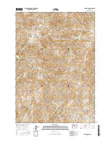
2017 Map of Jennies Peak
USGS Topo · Published 2017About this map
Jennies Peak rises as a central landmark in this high-desert portion of Wasco County, situated near the Wheeler County line. The landscape is defined by a complex network of drainage systems, including the deeply incised Eagle Canyon, Robinson Canyon, and Rattlesnake Canyon. This topography reflects the characteristic basalt-driven geology of North-Central Oregon, where elevated points like Coyote Mtn and Sheep Mtn overlook flat volcanic plateaus such as Breo Flat and Juniper Flat. Water sources in this arid environment are highly localized, found primarily at Nicholson Spring and Sand Spring, which would have been critical points for range management and wildlife. The presence of Sluice Canyon and Dugout Canyon suggests a history of surface water erosion and perhaps early ranching infrastructure in the canyons below Black Top.
Find a feature on this map
33 named features on this map. Tap any name to fly to it.
Don’t see what you’re looking for? This feature index may not catch every label — zoom into the map to look around manually.
Map Details
Editions of this 2017 Jennies Peak Map
This is the sole edition of this map. No revisions or reprints were ever made.
Other maps of this area

1926 · Mitchell
USGS Topo · 1:125,000

1955 · Bend
USGS Topo · 1:250,000

1957 · Bend
USGS Topo · 1:250,000

1958 · Bend
USGS Topo · 1:250,000

1966 · Mitchell
USGS Topo · 1:62,500

1966 · Kinzua
USGS Topo · 1:62,500

1966 · Clarno
USGS Topo · 1:62,500

1968 · Painted Hills
USGS Topo · 1:24,000
1968 · Sandrock Mtn
USGS Topo · 1:24,000

1981 · Stephenson Mountain
USGS Topo · 1:100,000