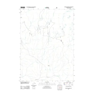
2012 Map of Jensen Meadows
USGS Topo · Published 2012About this map
Jensen Meadows and the surrounding high-country water network of Sublette County are documented in this 2012 study, which captures a landscape defined by historic transit routes and alpine drainage. The map preserves the alignment of the Lander Cutoff Rd and Elkhorn Cutoff Rd, legacy pathways that speak to the region's importance as a corridor for westward movement and later ranching operations.
Find a feature on this map
29 named features on this map. Tap any name to fly to it.
Don’t see what you’re looking for? This feature index may not catch every label — zoom into the map to look around manually.
Map Details
Editions of this 2012 Jensen Meadows Map
This is the sole edition of this map. No revisions or reprints were ever made.
Other maps of this area

1953 · Sweetwater Gap
USGS Topo · 1:24,000

1955 · Lander
USGS Topo · 1:250,000

1958 · Lander
USGS Topo · 1:250,000

1958 · Parting of the Ways
USGS Topo · 1:62,500

1961 · Lander
USGS Topo · 1:250,000

1969 · Leckie Reservoir
USGS Topo · 1:24,000

1969 · Jensen Meadows
USGS Topo · 1:24,000
1969 · Big Sandy Opening
USGS Topo · 1:24,000
1969 · Sweetwater Needles
USGS Topo · 1:24,000
1969 · Leckie
USGS Topo · 1:24,000