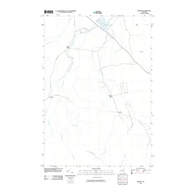
2010 Map of Jericho
USGS Topo · Published 2010About this map
Jericho and the surrounding woodlands of Clinton County define this area within the northern reaches of Adirondack Park. The landscape is characterized by a dense network of watercourses, where the Great Chazy River flows near Miner Lake and numerous tributaries like Stillwater Brook and Brandy Brook drain the wooded terrain. Settlement patterns are concentrated around historic points such as Purdys Mill and Jerusalem, connected by a web of local routes including Rand Hill Rd and Jerusalem Rd. The topography rises toward Big Hill in the east, while the northern extent features distinctive geological markers like Flat Rock. This survey reflects a region where traditional New York settlements persist alongside preserved natural boundaries, providing a clear view of the rural crossroads and small community hubs as they functioned in the early 21st century.
Find a feature on this map
31 named features on this map. Tap any name to fly to it.
Don’t see what you’re looking for? This feature index may not catch every label — zoom into the map to look around manually.
Map Details
Editions of this 2010 Jericho Map
This is the sole edition of this map. No revisions or reprints were ever made.
Other maps of this area

1895 · Mooers
USGS Topo · 1:62,500

1899 · Mooers
USGS Topo · 1:62,500

1911 · Lyon Mountain
USGS Topo · 1:62,500

1913 · Dannemora
USGS Topo · 1:62,500

1913 · Lyon Mountain
USGS Topo · 1:62,500

1915 · Churubusco
USGS Topo · 1:62,500

1931 · Lyon Mountain
USGS Topo · 1:62,500

1942 · Mooers
USGS Topo · 1:62,500

1943 · Churubusco
USGS Topo · 1:62,500

1943 · Mooers
USGS Topo · 1:62,500