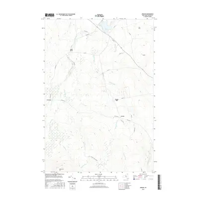
2016 Map of Jericho
USGS Topo · Published 2016About this map
The Great Chazy River flows through the northern reaches of this Clinton County landscape, anchoring a region defined by its timber and water resources. Small settlements like Jericho, Jerusalem, and Alder Bend dot the terrain, connected by a network of rural roads such as Rand Hill Rd and Jerusalem Rd. The elevation shifts dramatically toward the south where the Adirondack Park Preserve begins, dominated by the heights of Dannemora Mtn. This topographic survey captures the transition from the low-lying wetlands around Miner Lake and Dead Sea to the higher forested slopes of Big Hill. Historical industrial activity is suggested by Purdys Mill, while various waterways including Stillwater Brook and Brandy Brook drain the diverse terrain of the Champlain Valley's western edge.
Find a feature on this map
38 named features on this map. Tap any name to fly to it.
Don’t see what you’re looking for? This feature index may not catch every label — zoom into the map to look around manually.
Map Details
Editions of this 2016 Jericho Map
This is the sole edition of this map. No revisions or reprints were ever made.
Other maps of this area

1895 · Mooers
USGS Topo · 1:62,500

1899 · Mooers
USGS Topo · 1:62,500

1911 · Lyon Mountain
USGS Topo · 1:62,500

1913 · Dannemora
USGS Topo · 1:62,500

1913 · Lyon Mountain
USGS Topo · 1:62,500

1915 · Churubusco
USGS Topo · 1:62,500

1931 · Lyon Mountain
USGS Topo · 1:62,500

1942 · Mooers
USGS Topo · 1:62,500

1943 · Churubusco
USGS Topo · 1:62,500

1943 · Mooers
USGS Topo · 1:62,500