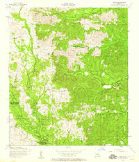
1954 Map of Jericho
USGS Topo · Published 1959About this map
Jericho and the surrounding pine-clad landscape of central Louisiana are defined by a complex network of timber-related infrastructure and watercourses in the mid-1950s. The terrain is notably etched by a dismantled railroad that snakes through the ridges, including the Dough Hills, signaling the area's transition away from early-century intensive logging. Small centers of local life persist at Clifton and Pisgah Church, where the geography is still largely tied to the winding paths of Indian Creek and Canal Bayou.
Find a feature on this map
20 named features on this map. Tap any name to fly to it.
Don’t see what you’re looking for? This feature index may not catch every label — zoom into the map to look around manually.
Map Details
Editions of this 1954 Jericho Map
4 editions found
Other maps of this area

1932 · Boyce SW
USGS Topo · 1:31,680

1937 · Chopin NE
USGS Topo · 1:31,680

1937 · Chopin SW
USGS Topo · 1:31,680

1937 · Chopin NW
USGS Topo · 1:31,680

1937 · Chopin SE
USGS Topo · 1:31,680

1941 · Boyce
USGS Topo · 1:62,500

1943 · Leander
USGS Topo · 1:62,500

1944 · Chopin
USGS Topo · 1:62,500

1948 · Chopin
USGS Topo · 1:62,500

1949 · Boyce NW
USGS Topo · 1:31,680