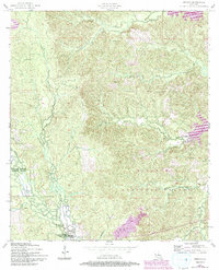
1954 Map of Jericho
USGS Topo · Published 1993About this map
Jericho and the surrounding pine-clad terrain of Kisatchie National Forest anchor this 1950s survey, updated in the early 1990s. The landscape is defined by the Rough Hills and a complex drainage system including Sieper Creek, Williamson Creek, and Comrade Creek. These waterways and their tributaries carved the winding contours that dictated the placement of early settlements and roads through Rapides and Vernon Parishes.
Find a feature on this map
19 named features on this map. Tap any name to fly to it.
Don’t see what you’re looking for? This feature index may not catch every label — zoom into the map to look around manually.
Map Details
Editions of this 1954 Jericho Map
4 editions found
Other maps of this area

1932 · Boyce SW
USGS Topo · 1:31,680

1937 · Chopin NE
USGS Topo · 1:31,680

1937 · Chopin SW
USGS Topo · 1:31,680

1937 · Chopin NW
USGS Topo · 1:31,680

1937 · Chopin SE
USGS Topo · 1:31,680

1941 · Boyce
USGS Topo · 1:62,500

1943 · Leander
USGS Topo · 1:62,500

1944 · Chopin
USGS Topo · 1:62,500

1948 · Chopin
USGS Topo · 1:62,500

1949 · Boyce NW
USGS Topo · 1:31,680