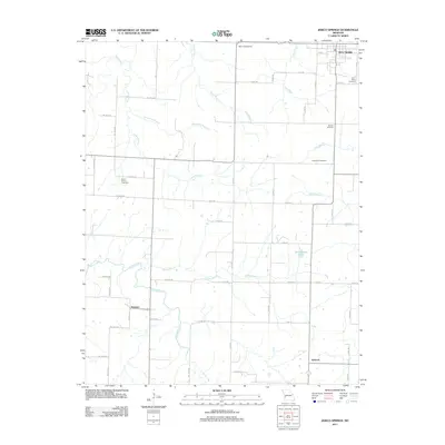
2011 Map of Jerico Springs
USGS Topo · Published 2011About this map
Jerico Springs anchors the northeast corner of this Southwest Missouri landscape, where the prairie begins to break into the wooded drainages of the Horse Creek basin. This 2011 survey documents a predominantly agricultural region defined by a grid of county roads and a network of small waterways including Patton Branch, Lacey Branch, and Bear Creek. The map provides significant detail for genealogists, marking several distinct burial grounds such as Round Prairie Cemetery and German Cemetery, which reflect the area's early settlement patterns and community centers.
Find a feature on this map
53 named features on this map. Tap any name to fly to it.
Don’t see what you’re looking for? This feature index may not catch every label — zoom into the map to look around manually.
Map Details
Editions of this 2011 Jerico Springs Map
This is the sole edition of this map. No revisions or reprints were ever made.
Other maps of this area

1886 · Nevada
USGS Topo · 1:125,000

1886 · Stockton
USGS Topo · 1:125,000

1886 · Greenfield
USGS Topo · 1:125,000

1886 · Carthage
USGS Topo · 1:125,000

1888 · Greenfield
USGS Topo · 1:125,000

1894 · Nevada
USGS Topo · 1:125,000

1894 · Carthage
USGS Topo · 1:125,000

1947 · Joplin
USGS Topo · 1:250,000

1949 · Joplin
USGS Topo · 1:250,000

1954 · Springfield
USGS Topo · 1:250,000