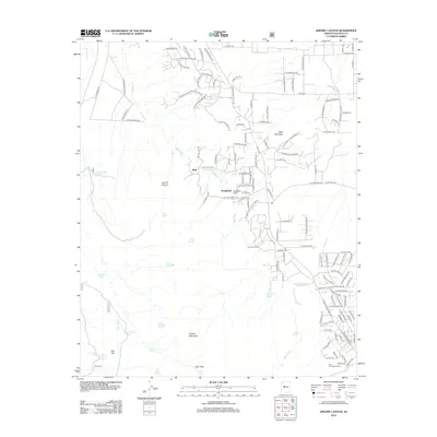
2012 Map of Jerome Canyon
USGS Topo · Published 2012About this map
Granite Mountain dominates the southwestern portion of this Yavapai County landscape, providing a high-elevation backdrop to the networks of washes and ranching settlements below. This 2012 survey reveals a transition from traditional pastoral lands to modern residential development, centered around the historic Stringfield Ranch and American Ranch locales. The hydrology is defined by the ephemeral Mint Wash, which winds through the central valley, supported by a network of cattle tanks and springs such as Alkali Spring and Baker Spring. In the rugged north, Jerome Canyon cuts through the terrain near Table Mountain, while the southern reaches transition toward Blair Pass. Cultural geography is anchored by family-named landmarks like Lon Stringfield Ranch and the small community of Mint, illustrating the long-term human footprint on this semi-arid high desert environment.
Find a feature on this map
139 named features on this map. Tap any name to fly to it.
Don’t see what you’re looking for? This feature index may not catch every label — zoom into the map to look around manually.
Map Details
Editions of this 2012 Jerome Canyon Map
This is the sole edition of this map. No revisions or reprints were ever made.
Other maps of this area

1887 · Prescott
USGS Topo · 1:250,000

1892 · Prescott
USGS Topo · 1:250,000

1905 · Jerome
USGS Topo · 1:125,000

1947 · Simmons
USGS Topo · 1:62,500

1947 · Iron Springs
USGS Topo · 1:62,500

1947 · Paulden
USGS Topo · 1:62,500

1947 · Prescott
USGS Topo · 1:62,500

1948 · Iron Springs
USGS Topo · 1:63,360

1948 · Prescott
USGS Topo · 1:62,500

1948 · Simmons
USGS Topo · 1:63,360