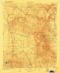
1905 Map of Jerome
USGS Topo · Published 1922About this map
Prescott and the surrounding copper-rich highlands of central Arizona appear here during a period of significant industrial and infrastructure development. The landscape is dominated by the steep topography of the Black Hills and Mingus Mt, which separate the ranching operations in Lonesome Valley from the mining activities at Jerome. The regional economy is anchored by a complex network of narrow and standard-gauge tracks, including the United Verde and Pacific RR and the Santa Fe Prescott and Phoenix RR.
Find a feature on this map
74 named features on this map. Tap any name to fly to it.
Don’t see what you’re looking for? This feature index may not catch every label — zoom into the map to look around manually.
Map Details
Editions of this 1905 Jerome Map
2 editions found

Other maps of this area

1886 · San Francisco Mtns
USGS Topo · 1:250,000

1886 · Chino
USGS Topo · 1:250,000

1887 · Verde
USGS Topo · 1:250,000

1887 · Prescott
USGS Topo · 1:250,000

1891 · San Francisco Mtns
USGS Topo · 1:250,000

1891 · Chino
USGS Topo · 1:250,000

1892 · Verde
USGS Topo · 1:250,000

1892 · Prescott
USGS Topo · 1:250,000

1894 · San Francisco Mtns
USGS Topo · 1:250,000

1899 · San Francisco Mtns
USGS Topo · 1:250,000