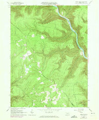
1965 Map of Jersey Mills
USGS Topo · Published 1974About this map
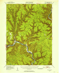
Pine Creek Gorge dominates the eastern half of this landscape, carved by the waters of Pine Creek as it flows past the small settlement of Jersey Mills. The area shows a transition from the river-level valley to the high plateaus of the Tiadaghton State Forest and Sproul State Forest, accessed by early mountain routes like the Old Coudersport Road. Traces of local industry and community life appear in the form of Quarries and the Haneyville Ch and its adjacent Cem.
Find a feature on this map
57 named features on this map. Tap any name to fly to it.
Don’t see what you’re looking for? This feature index may not catch every label — zoom into the map to look around manually.
Map Details
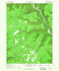
Editions of this 1965 Jersey Mills Map
3 editions found

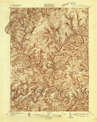
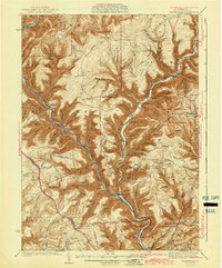
Other maps of this area

1921 · Howard
USGS Topo · 1:48,000

1921 · Lock Haven
USGS Topo · 1:62,500

1923 · Howard
USGS Topo · 1:62,500

1923 · Lock Haven
USGS Topo · 1:62,500

1935 · Waterville
USGS Topo · 1:24,000
1937 · Waterville
USGS Topo · 1:48,000

1943 · Hyner
USGS Topo · 1:62,500
1943 · Waterville
USGS Topo · 1:62,500

1944 · Lock Haven
USGS Topo · 1:62,500
1946 · Renovo East
USGS Topo · 1:62,500
Featured Places
- Gallagher Township, PA
- Watson Township, PA
- McHenry Township, PA
- Cummings Township, PA
- Jersey Mills, McHenry Township