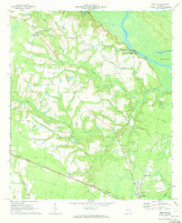
1970 Map of Jesup NW
USGS Topo · Published 1973About this map
Altamaha River bottomlands dominate the eastern edge of this landscape, where Oglethorpe Bluff overlooks Carter Island and the winding Hughes Old River. The terrain transitions from these low-lying swampy corridors to a mosaic of timberland and clearings, marked by a density of rural spiritual centers including Altamaha Ch, Blanton Grove Ch, and Bethesda Ch. These churches, often paired with small local cemeteries, served as the anchors for scattered communities like Madray Springs and Redland.
Find a feature on this map
34 named features on this map. Tap any name to fly to it.
Don’t see what you’re looking for? This feature index may not catch every label — zoom into the map to look around manually.
Map Details
Editions of this 1970 Jesup NW Map
2 editions found
Other maps of this area

1918 · Jesup
USGS Topo · 1:62,500

1920 · Glennville
USGS Topo · 1:62,500

1943 · Jesup
USGS Topo · 1:62,500

1944 · Glennville
USGS Topo · 1:62,500

1946 · Brunswick
USGS Topo · 1:250,000

1948 · Brunswick
USGS Topo · 1:250,000

1950 · Glennville
USGS Topo · 1:62,500

1953 · Waycross
USGS Topo · 1:250,000

1956 · Brunswick
USGS Topo · 1:250,000

1958 · Waycross
USGS Topo · 1:250,000