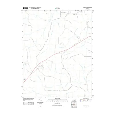
2010 Map of Jetersville
USGS Topo · Published 2010About this map
Jetersville serves as a central hub in this section of Amelia County, where the road network including S Amelia Ave and Jetersville Rd converges. The landscape is defined by an intricate system of drainages, notably North Buckskin Creek and South Buckskin Creek, which flow through the southern territory, while North Branch Nibbs Creek and its southern counterpart divide the northern reaches. Small agricultural or residential settlements like Maplewood, Otterburn, and Truxillo are scattered along the rural routes, often adjacent to family or community landmarks such as Salem Cemetery and Good Hope Cemetery. The presence of several small water control structures, including Manns Dam and Bultje Dam, suggests a history of managed water resources for local use. Open spaces like Easter Field and the naming of local landmarks after families, such as Holtes Dam, provide specific points of interest for those tracing the local heritage and land use of this Virginia Piedmont region.
Find a feature on this map
47 named features on this map. Tap any name to fly to it.
Don’t see what you’re looking for? This feature index may not catch every label — zoom into the map to look around manually.
Map Details
Editions of this 2010 Jetersville Map
This is the sole edition of this map. No revisions or reprints were ever made.
Other maps of this area

1891 · Farmville
USGS Topo · 1:125,000

1893 · Farmville
USGS Topo · 1:125,000

1897 · Amelia
USGS Topo · 1:125,000

1943 · Amelia
USGS Topo · 1:31,680
1943 · Chula
USGS Topo · 1:24,000

1943 · Richmond
USGS Topo · 1:250,000

1944 · Chula
USGS Topo · 1:31,680

1947 · Roanoke
USGS Topo · 1:250,000

1949 · Richmond
USGS Topo · 1:250,000
1950 · Wellville
USGS Topo · 1:24,000