
1943 Map of Amelia
USGS Topo · Published 1943About this map
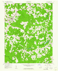
The Amelia courthouse area and its surrounding rural communities are captured here in detail during the early 1940s. The Southern railroad serves as the primary corridor for the region, connecting Otterburn and Winterham to the larger rail network. This era shows a landscape deeply rooted in agrarian life and local industry, evidenced by landmarks like Whites Mill on Smacks Creek and Beaverpond Mill further south. The map provides a look at the social geography of the time, documenting a high density of rural institutions such as the Russell Grove High School, Chula School, and numerous country churches including Promised Land Church and Mt Olive Church. Local commerce is represented by crossroad landmarks like Brays Store and Ponton Store, which served as hubs for the outlying farmsteads along Nibbs Creek and Deep Creek.
Find a feature on this map
38 named features on this map. Tap any name to fly to it.
Don’t see what you’re looking for? This feature index may not catch every label — zoom into the map to look around manually.
Map Details
Editions of this 1943 Amelia Map
2 editions found
Other maps of this area

1891 · Farmville
USGS Topo · 1:125,000

1893 · Farmville
USGS Topo · 1:125,000

1897 · Amelia
USGS Topo · 1:125,000

1943 · Goodes Bridge
USGS Topo · 1:31,680

1943 · Clayville
USGS Topo · 1:24,000
1943 · Chula
USGS Topo · 1:24,000

1943 · Richmond
USGS Topo · 1:250,000

1944 · Chula
USGS Topo · 1:31,680
1944 · Clayville
USGS Topo · 1:31,680

1947 · Roanoke
USGS Topo · 1:250,000