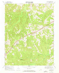
1968 Map of Jetersville
USGS Topo · Published 1972About this map
The Southern railroad corridor dictates the settlement pattern across this rural landscape, running diagonally through the heart of the region. The village of Jetersville stands as a primary hub along the line, accompanied by the community at Maplewood to the northeast. This area of central Virginia is defined by an intricate network of waterways, including Flat Creek and Buckskin Creek, which carve through the terrain and create the natural boundaries between farms and timber tracts. A strong sense of community life is evident in the distribution of country churches, such as Union Branch Ch, St James Ch, and Ebenezer Ch, which are scattered along the secondary roads. The map also records the boundary line between Amelia Co and Nottoway Co, showing how political divisions intersect the various branches of Nibbs Creek and Beaverpond Creek.
Find a feature on this map
29 named features on this map. Tap any name to fly to it.
Don’t see what you’re looking for? This feature index may not catch every label — zoom into the map to look around manually.
Map Details
Editions of this 1968 Jetersville Map
This is the sole edition of this map. No revisions or reprints were ever made.
Other maps of this area

1891 · Farmville
USGS Topo · 1:125,000

1893 · Farmville
USGS Topo · 1:125,000

1897 · Amelia
USGS Topo · 1:125,000

1943 · Amelia
USGS Topo · 1:31,680
1943 · Chula
USGS Topo · 1:24,000

1943 · Richmond
USGS Topo · 1:250,000

1944 · Chula
USGS Topo · 1:31,680

1947 · Roanoke
USGS Topo · 1:250,000

1949 · Richmond
USGS Topo · 1:250,000
1950 · Wellville
USGS Topo · 1:24,000