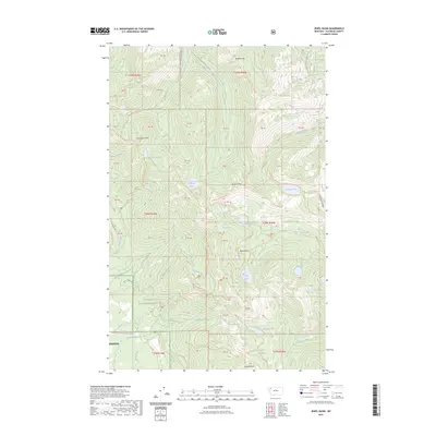
2023 Map of Jewel Basin
USGS Topo · Published 2023About this map
Flathead National Forest encompasses the high country shown here, defined by the sharp elevations of the Swan Range. This landscape is marked by a dense concentration of subalpine water bodies, including Picnic Lakes, Wildcat Lake, and the larger Birch Lake situated in the southern reach. The drainage patterns are intricate, with Wildcat Creek and Wounded Buck Creek flowing from the slopes of Wildcat Mtn.
Find a feature on this map
74 named features on this map. Tap any name to fly to it.
Don’t see what you’re looking for? This feature index may not catch every label — zoom into the map to look around manually.
Map Details
Editions of this 2023 Jewel Basin Map
This is the sole edition of this map. No revisions or reprints were ever made.
Other maps of this area

1914 · Nyack
USGS Topo · 1:125,000

1943 · Kalispell
USGS Topo · 1:125,000

1957 · Kalispell
USGS Topo · 1:250,000

1960 · Kalispell
USGS Topo · 1:250,000

1960 · Cut Bank
USGS Topo · 1:250,000

1961 · Kalispell
USGS Topo · 1:250,000

1962 · Doris Mountain
USGS Topo · 1:24,000

1962 · Hash Mountain
USGS Topo · 1:24,000
1962 · Bigfork
USGS Topo · 1:24,000

1963 · Cut Bank
USGS Topo · 1:250,000