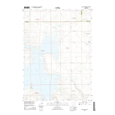
2015 Map of Jewel Springs
USGS Topo · Published 2015About this map
Glendo Reservoir dominates the western landscape of this Wyoming quadrangle, where the water's reach meets the complex terrain of the High Plains. This 2015 survey reveals a rugged geography defined by sharp transitions, from the depths of Morris Canyon to the heights of Rattlesnake Ridge. The map identifies strategic geological landmarks like Sentinal Rock and Sentinel Rock, which likely served as navigational aids for early travelers through Muddy Gap.
Find a feature on this map
35 named features on this map. Tap any name to fly to it.
Don’t see what you’re looking for? This feature index may not catch every label — zoom into the map to look around manually.
Map Details
Editions of this 2015 Jewel Springs Map
This is the sole edition of this map. No revisions or reprints were ever made.
Other maps of this area

1896 · Hartville
USGS Topo · 1:125,000

1901 · Hartville
USGS Topo · 1:125,000

1949 · Shawnee
USGS Topo · 1:24,000

1949 · Cedar Top
USGS Topo · 1:24,000

1950 · Glendo
USGS Topo · 1:24,000

1950 · Amend Ranch
USGS Topo · 1:24,000

1950 · Cedar Top
USGS Topo · 1:24,000

1950 · Prairie View School
USGS Topo · 1:24,000

1950 · Shawnee
USGS Topo · 1:24,000

1950 · Jewel Springs
USGS Topo · 1:24,000