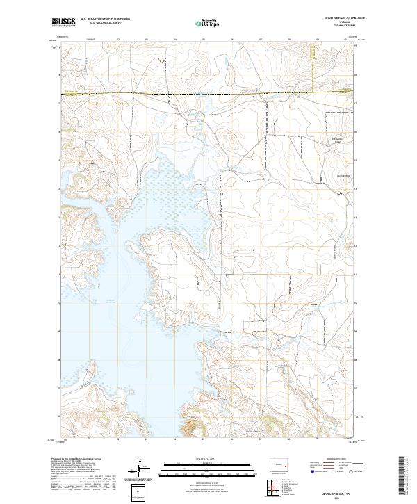
2021 Map of Jewel Springs
USGS Topo · Published 2021About this map
Glendo Reservoir dominates the western portion of this landscape, its fluctuating shoreline carved into the surrounding high plains. Located at the intersection of Platte, Converse, and Niobrara counties, the area is characterized by a network of drainage systems like Muddy Cr and Cottonwood Cr that feed into the reservoir basin. The eastern topography rises toward distinctive landmarks including Sentinel Rock and the high spine of Rattlesnake Ridge.
Find a feature on this map
36 named features on this map. Tap any name to fly to it.
Don’t see what you’re looking for? This feature index may not catch every label — zoom into the map to look around manually.
Map Details
Editions of this 2021 Jewel Springs Map
This is the sole edition of this map. No revisions or reprints were ever made.
Other maps of this area

1896 · Hartville
USGS Topo · 1:125,000

1901 · Hartville
USGS Topo · 1:125,000

1949 · Shawnee
USGS Topo · 1:24,000

1949 · Cedar Top
USGS Topo · 1:24,000

1950 · Glendo
USGS Topo · 1:24,000

1950 · Amend Ranch
USGS Topo · 1:24,000

1950 · Cedar Top
USGS Topo · 1:24,000

1950 · Prairie View School
USGS Topo · 1:24,000

1950 · Shawnee
USGS Topo · 1:24,000

1950 · Jewel Springs
USGS Topo · 1:24,000