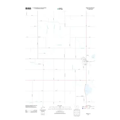
2013 Map of Jewell
USGS Topo · Published 2013About this map
Jewell serves as the primary hub of this Hamilton County landscape, where the residential street grid includes King St and Carmichael St near the intersection of several regional highways. The surrounding terrain is defined by a complex drainage system, evidenced by numerous engineered waterways such as Grove Branch Ditch, Loop Branch Ditch, and Rahto Branch Ditch. These ditches underscore the region's agricultural history, where land management was essential for stabilizing the prairie soil for cultivation. To the south, Little Wall Lake and the nearby Lund Airport mark the transition from the town center to the rural expanses. The map also captures smaller natural and semi-natural features like Goose Lake and Keigley Br, reflecting the hydrology of the Iowa plains before they meet the more defined sections of the sectional road grid.
Find a feature on this map
46 named features on this map. Tap any name to fly to it.
Don’t see what you’re looking for? This feature index may not catch every label — zoom into the map to look around manually.
Map Details
Editions of this 2013 Jewell Map
This is the sole edition of this map. No revisions or reprints were ever made.
Other maps of this area

1912 · Ames
USGS Topo · 1:62,500

1914 · Ames
USGS Topo · 1:62,500

1916 · Boone
USGS Topo · 1:62,500

1954 · Waterloo
USGS Topo · 1:250,000

1955 · Waterloo
USGS Topo · 1:250,000

1965 · Mackey
USGS Topo · 1:24,000

1975 · Ames NW
USGS Topo · 1:24,000

1975 · Story City
USGS Topo · 1:24,000

1978 · Blairsburg
USGS Topo · 1:24,000

1978 · Ellsworth
USGS Topo · 1:24,000
Featured Places
- Jewell Junction, IA
- Jewell, Jewell Junction
- Clear Lake Township, IA
- Hamilton Township, IA
- Lyon Township, IA