
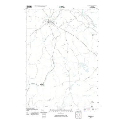
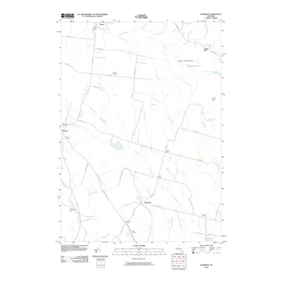
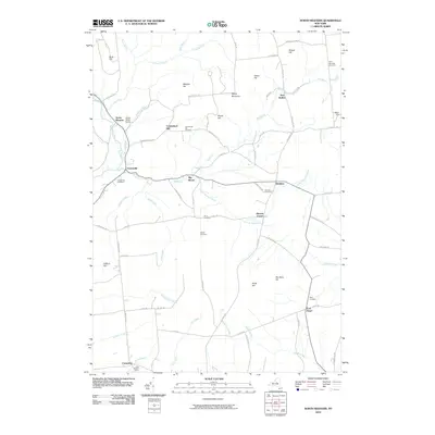
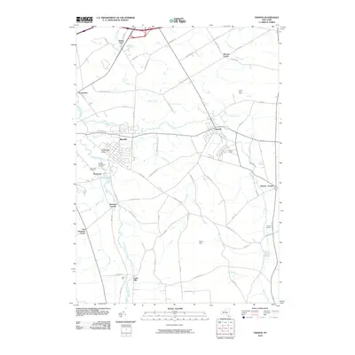
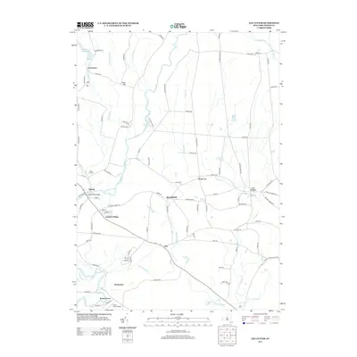
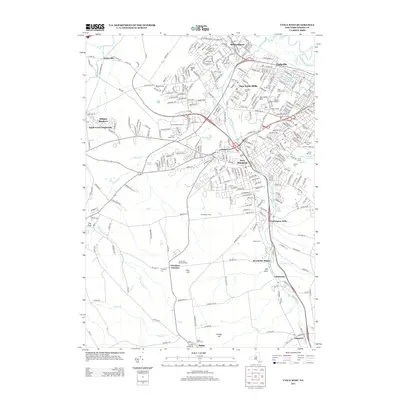
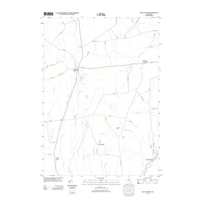
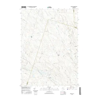
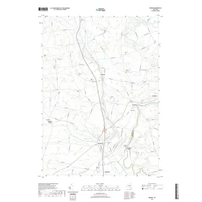
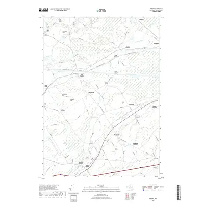
1941 Map of Jewell
USGS Topo · Published 1941About this map
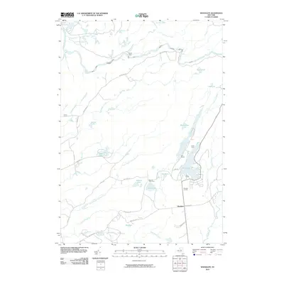
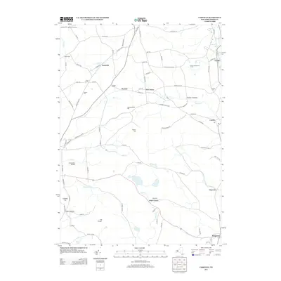
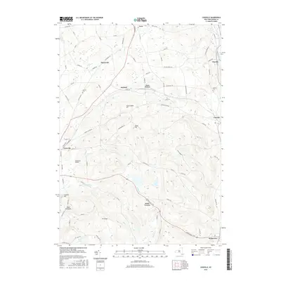
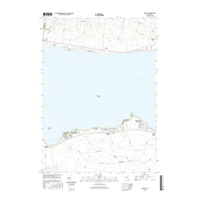
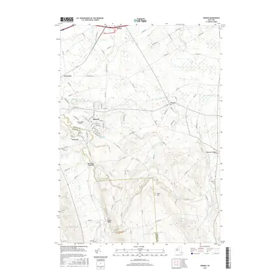
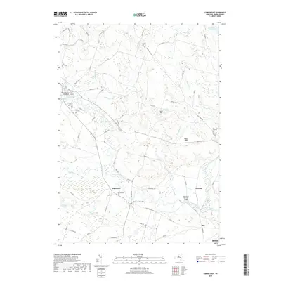
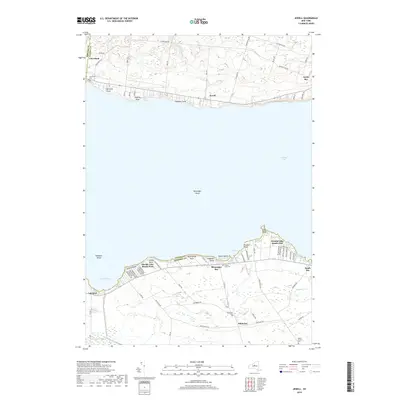
Oneida Lake dominates this 1941 survey, which captures the distinct development patterns of its northern and southern shores just before the mid-century. On the northern bank, the hamlet of Jewell sits along New York State Highway No 49, flanked by several distinctive lakefront points such as Nunnery Pt and Godfreys Pt. To the south, the landscape transitions into the agricultural and marshy terrain of Sullivan, where the Barge Canal Route cuts a straight line through the water. This southern shore is densely marked with family-named landmarks and local institutions, from Lakeport Chapel and West School near Lakeport to the rural crossroads of Whitelaw and its namesake Whitelaw Cem. The map provides a clear look at the early resort and residential clusters of Oneida Lake Beach West and Oneida Lake Beach East before the post-war building boom altered these shorelines.
Find a feature on this map
54 named features on this map. Tap any name to fly to it.
Don’t see what you’re looking for? This feature index may not catch every label — zoom into the map to look around manually.
Map Details
Editions of this 1941 Jewell Map
This is the sole edition of this map. No revisions or reprints were ever made.
Historical Maps of Sullivan Through Time
127 maps found

1897 Remsen
Oneida County, NY

1900 Remsen
Oneida County, NY

1904 Boonville
Oneida County, NY

1905 Taberg
Oneida County, NY
1941 Jewell
Oneida County, NY

1943 Camden East
Oneida County, NY

1943 Camden West
Oneida County, NY

1943 Cassville
Oneida County, NY

1943 East Florence
Oneida County, NY

1943 Lee Center
Oneida County, NY

1943 Westdale
Oneida County, NY

1944 Jewell
Oneida County, NY

1945 Boonville
Oneida County, NY

1945 Cassville
Oneida County, NY

1945 Forestport
Oneida County, NY

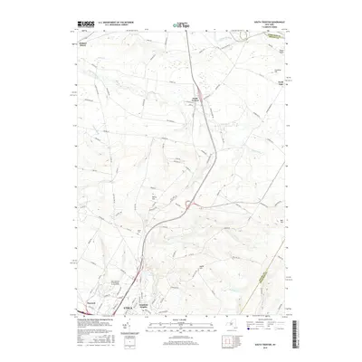
1945 South Trenton
Oneida County, NY

1946 Remsen
Oneida County, NY

1946 Westdale
Oneida County, NY

1946 West Leyden
Oneida County, NY

1947 Boonville
Oneida County, NY

1947 Forestport
Oneida County, NY

1947 North Western
Oneida County, NY

1947 Remsen
Oneida County, NY

1947 West Leyden
Oneida County, NY

1948 Vernon
Oneida County, NY

1948 Verona
Oneida County, NY

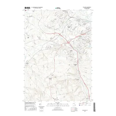
1949 Utica West
Oneida County, NY

1955 Boonville
Oneida County, NY

1955 Camden East
Oneida County, NY

1955 Florence
Oneida County, NY

1955 Lee Center
Oneida County, NY

1955 North Western
Oneida County, NY

1955 Remsen
Oneida County, NY

1955 South Trenton
Oneida County, NY

1955 Utica West
Oneida County, NY

1955 Vernon
Oneida County, NY

1955 Verona
Oneida County, NY

1955 West Leyden
Oneida County, NY

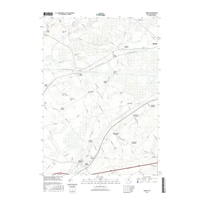
1957 Jewell
Oneida County, NY

1959 Westdale
Oneida County, NY

1960 Camden West
Oneida County, NY

1983 South Trenton
Oneida County, NY
2010 Boonville
Oneida County, NY
2010 Camden East
Oneida County, NY
2010 Camden West
Oneida County, NY
2010 Cassville
Oneida County, NY
2010 Florence
Oneida County, NY
2010 Forestport
Oneida County, NY
2010 Jewell
Oneida County, NY
2010 Lee Center
Oneida County, NY
2010 North Western
Oneida County, NY
2010 Remsen
Oneida County, NY
2010 South Trenton
Oneida County, NY
2010 Utica West
Oneida County, NY
2010 Vernon
Oneida County, NY
2010 Verona
Oneida County, NY
2010 Westdale
Oneida County, NY
2010 West Leyden
Oneida County, NY
2010 Woodgate
Oneida County, NY
2013 Boonville
Oneida County, NY
2013 Camden East
Oneida County, NY
2013 Camden West
Oneida County, NY
2013 Cassville
Oneida County, NY
2013 Florence
Oneida County, NY
2013 Forestport
Oneida County, NY
2013 Jewell
Oneida County, NY
2013 Lee Center
Oneida County, NY
2013 North Western
Oneida County, NY
2013 Remsen
Oneida County, NY
2013 South Trenton
Oneida County, NY
2013 Utica West
Oneida County, NY
2013 Vernon
Oneida County, NY
2013 Verona
Oneida County, NY
2013 Westdale
Oneida County, NY
2013 West Leyden
Oneida County, NY
2013 Woodgate
Oneida County, NY
2016 Boonville
Oneida County, NY
2016 Camden East
Oneida County, NY
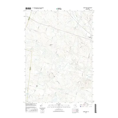
2016 Camden West
Oneida County, NY
2016 Cassville
Oneida County, NY
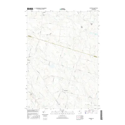
2016 Florence
Oneida County, NY
2016 Forestport
Oneida County, NY
2016 Jewell
Oneida County, NY
2016 Lee Center
Oneida County, NY
2016 North Western
Oneida County, NY
2016 Remsen
Oneida County, NY
2016 South Trenton
Oneida County, NY
2016 Utica West
Oneida County, NY
2016 Vernon
Oneida County, NY
2016 Verona
Oneida County, NY
2016 Westdale
Oneida County, NY
2016 West Leyden
Oneida County, NY
2016 Woodgate
Oneida County, NY
2019 Boonville
Oneida County, NY
2019 Camden East
Oneida County, NY
2019 Camden West
Oneida County, NY
2019 Cassville
Oneida County, NY
2019 Florence
Oneida County, NY
2019 Forestport
Oneida County, NY
2019 Jewell
Oneida County, NY
2019 Lee Center
Oneida County, NY
2019 North Western
Oneida County, NY
2019 Remsen
Oneida County, NY
2019 South Trenton
Oneida County, NY
2019 Utica West
Oneida County, NY
2019 Vernon
Oneida County, NY
2019 Verona
Oneida County, NY
2019 Westdale
Oneida County, NY
2019 West Leyden
Oneida County, NY
2019 Woodgate
Oneida County, NY

2023 Boonville
Oneida County, NY

2023 Camden East
Oneida County, NY

2023 Camden West
Oneida County, NY

2023 Cassville
Oneida County, NY

2023 Florence
Oneida County, NY

2023 Forestport
Oneida County, NY

2023 Jewell
Oneida County, NY

2023 Lee Center
Oneida County, NY

2023 North Western
Oneida County, NY

2023 Remsen
Oneida County, NY

2023 South Trenton
Oneida County, NY

2023 Utica West
Oneida County, NY

2023 Vernon
Oneida County, NY

2023 Verona
Oneida County, NY

2023 Westdale
Oneida County, NY

2023 West Leyden
Oneida County, NY

2023 Woodgate
Oneida County, NY