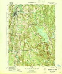
1944 Map of Jewett City
USGS Topo · Published 1944About this map
Jewett City serves as the industrial and transportation anchor for this mid-century portrait of New London County, situated at the confluence of the Pachaug River and Quinebaug River. The village's importance is underscored by the New York New Haven and Hartford railroad line and a dense network of local roads including Hartford Road and Norwich Road. Moving east and south, the landscape shifts from the compact manufacturing centers of Clayville and Glasgo into the wooded tracts of the Pachaug State Forest. The map documents a rural society deeply rooted in its local institutions, evidenced by numerous schoolhouses such as Pachaug Sch and the Northwest Corner Sch. A series of interconnected water bodies, including the expansive Pachaug Pond and Hopeville Pond, reveal how the river system was harnessed for both industry and recreation in townships like Griswold and Voluntown.
Find a feature on this map
44 named features on this map. Tap any name to fly to it.
Don’t see what you’re looking for? This feature index may not catch every label — zoom into the map to look around manually.
Map Details
Editions of this 1944 Jewett City Map
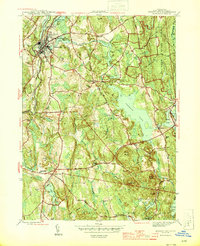
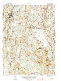
3 editions found
Other maps of this area

1889 · Stonington
USGS Topo · 1:62,500

1889 · Moosup
USGS Topo · 1:62,500

1892 · New London
USGS Topo · 1:62,500

1892 · Norwich
USGS Topo · 1:62,500

1893 · Moosup
USGS Topo · 1:62,500

1893 · Stonington
USGS Topo · 1:62,500

1893 · New London
USGS Topo · 1:62,500

1920 · Moosup
USGS Topo · 1:62,500

1921 · New London
USGS Topo · 1:62,500

1921 · Stonington
USGS Topo · 1:62,500