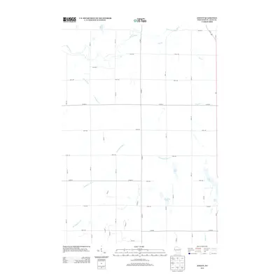
2013 Map of Jewett
USGS Topo · Published 2013About this map
Glacial geography and agricultural grid lines define this section of Saint Croix County. The northern portion of the landscape is dominated by the meandering Willow River and its tributary, the South Fork Willow River, which flow through a network of rural sections partitioned by numbered avenues and streets. To the south, the headwaters of the Kinnickinnic River and the Rush River emerge from a terrain dotted with small kettle lakes, including Bushnell Lake, Casey Lake, and Pine Lake. This 2013 survey illustrates the persistence of the rectangular survey system in western Wisconsin, where primary corridors like Co HWY-T and Us-63 provide the main north-south connectivity between dispersed farmsteads and the outlying drainages of Dry Run and Paperjack Cr.
Find a feature on this map
38 named features on this map. Tap any name to fly to it.
Don’t see what you’re looking for? This feature index may not catch every label — zoom into the map to look around manually.
Map Details
Editions of this 2013 Jewett Map
This is the sole edition of this map. No revisions or reprints were ever made.
Other maps of this area

1946 · River Falls
USGS Topo · 1:62,500

1948 · New Richmond
USGS Topo · 1:62,500

1949 · New Richmond
USGS Topo · 1:62,500

1949 · River Falls
USGS Topo · 1:62,500

1949 · Baldwin
USGS Topo · 1:62,500

1950 · Deer Park
USGS Topo · 1:62,500

1953 · Saint Paul
USGS Topo · 1:250,000

1953 · Stillwater
USGS Topo · 1:250,000

1955 · Stillwater
USGS Topo · 1:250,000

1958 · Stillwater
USGS Topo · 1:250,000