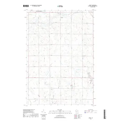
2018 Map of Jewett
USGS Topo · Published 2018About this map
The settlement of Jewett sits at the northern edge of this landscape, positioned where the S Fork Willow River joins the main course of the Willow River. This area of Saint Croix County is defined by a dense network of local roads and sections, reflecting a mature agricultural grid. Waterways like Paperjack Cr and Dry Run carve through the terrain, leading toward the southern drainage of the Kinnickinnic River and the upper reaches of the Rush River. Smaller basins such as Bushnell Lake, Casey Lake, and Goose Pond dot the glacial topography. The map also covers the southeastern boundary of New Richmond, illustrating how the city’s footprint meets the rural road system, including Co Hwy T and Co Hwy G, which serve as primary connectors for the outlying farmsteads and rural residences.
Find a feature on this map
43 named features on this map. Tap any name to fly to it.
Don’t see what you’re looking for? This feature index may not catch every label — zoom into the map to look around manually.
Map Details
Editions of this 2018 Jewett Map
This is the sole edition of this map. No revisions or reprints were ever made.
Other maps of this area

1946 · River Falls
USGS Topo · 1:62,500

1948 · New Richmond
USGS Topo · 1:62,500

1949 · New Richmond
USGS Topo · 1:62,500

1949 · River Falls
USGS Topo · 1:62,500

1949 · Baldwin
USGS Topo · 1:62,500

1950 · Deer Park
USGS Topo · 1:62,500

1953 · Saint Paul
USGS Topo · 1:250,000

1953 · Stillwater
USGS Topo · 1:250,000

1955 · Stillwater
USGS Topo · 1:250,000

1958 · Stillwater
USGS Topo · 1:250,000