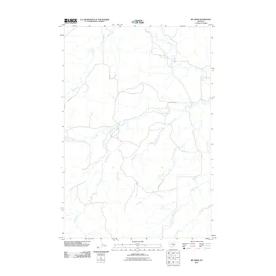
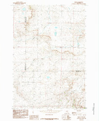
2011 Map of Jim Creek
USGS Topo · Published 2011About this map
Jim Creek and Potato Creek dominate this central Montana landscape, where a dense network of watercourses defines the agricultural and ranching potential of the region. The map illustrates a classic Great Plains drainage pattern, with Tony Creek, Antelope Creek, and Fish Creek carving paths through the terrain. The presence of rural routes such as Sourdough Rd, Hanson Rd, and Cooney Rd provides essential context for local family history and land use in this part of Wheatland County. Unlike earlier surveys, this 2011 edition shows the modern road network, including Ny Creek Rd and Berg Rd, which connect the isolated homesteads and grazing lands. The topography is meticulously detailed by the U.S. Geological Survey, showing how these creeks converge and shape the local geography south of the Musselshell River basin.
Find a feature on this map
13 named features on this map. Tap any name to fly to it.
Don’t see what you’re looking for? This feature index may not catch every label — zoom into the map to look around manually.
Map Details
Editions of this 2011 Jim Creek Map
This is the sole edition of this map. No revisions or reprints were ever made.
Other maps of this area

1889 · Big Snowy Mountain
USGS Topo · 1:250,000

1893 · Big Snowy Mountain
USGS Topo · 1:250,000

1954 · Roundup
USGS Topo · 1:250,000

1958 · Roundup
USGS Topo · 1:250,000
1985 · Upper Glaston Lake
USGS Topo · 1:24,000

1985 · Jim Creek
USGS Topo · 1:24,000
1985 · Gougley Creek
USGS Topo · 1:24,000

1985 · Progress
USGS Topo · 1:24,000
1985 · Gibson SW
USGS Topo · 1:24,000
1985 · Gibson
USGS Topo · 1:24,000