
1985 Map of Jim Creek
USGS Topo · Published 1985About this map
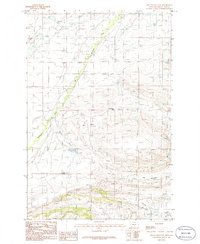
The Cayuse Hills define the western portion of this Montana landscape, where the high-plains terrain is etched by an intricate network of seasonal and perennial drainage systems. At the time of this mid-1980s field check, the area served as a remote intersection for three counties: Wheatland, Sweet Grass, and Golden Valley. The drainage patterns of Jim Creek, Potato Creek, and Antelope Creek illustrate the natural runoff routes from the higher elevations of the hills toward the lower valley basins. This provisional survey captures the region’s topography in high detail, showing the deep contouring of the coulees and draws that characterize this part of the state. Small landmarks like a lone Spring or the convergence of Fish Creek provide specific points of reference for those studying the hydrology and land use of this sparsely populated ranching and grazing territory during the late twentieth century.
Find a feature on this map
11 named features on this map. Tap any name to fly to it.
Don’t see what you’re looking for? This feature index may not catch every label — zoom into the map to look around manually.
Map Details
Editions of this 1985 Jim Creek Map
This is the sole edition of this map. No revisions or reprints were ever made.
Other maps of this area

1889 · Big Snowy Mountain
USGS Topo · 1:250,000

1893 · Big Snowy Mountain
USGS Topo · 1:250,000

1954 · Roundup
USGS Topo · 1:250,000

1958 · Roundup
USGS Topo · 1:250,000
1985 · Upper Glaston Lake
USGS Topo · 1:24,000
1985 · Gougley Creek
USGS Topo · 1:24,000

1985 · Progress
USGS Topo · 1:24,000
1985 · Gibson SW
USGS Topo · 1:24,000
1985 · Gibson
USGS Topo · 1:24,000
1986 · Ten O'Clock Gate
USGS Topo · 1:24,000