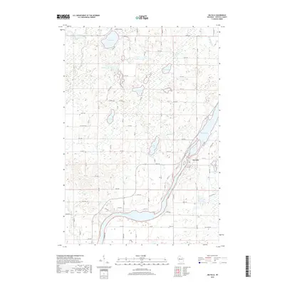
2018 Map of Jim Falls
USGS Topo · Published 2018About this map
The Chippewa River carves a sweeping path through this portion of Chippewa County, defining the local landscape as it feeds into Old Abe Lake near the settlement of Jim Falls. This 2018 survey illustrates a region defined by its glacial hydrology, with a dense cluster of kettle lakes and tributaries dotting the northern half of the quadrangle. Significant water bodies like Cornell Lake, Popple Lake, and Howe Lake are interconnected by smaller systems such as Jim Cr and the north and south forks of Bob Creek.
Find a feature on this map
60 named features on this map. Tap any name to fly to it.
Don’t see what you’re looking for? This feature index may not catch every label — zoom into the map to look around manually.
Map Details
Editions of this 2018 Jim Falls Map
This is the sole edition of this map. No revisions or reprints were ever made.
Other maps of this area

1934 · Chippewa Falls
USGS Topo · 1:62,500

1936 · Chippewa Falls
USGS Topo · 1:62,500

1949 · Bloomer
USGS Topo · 1:62,500

1951 · Bloomer
USGS Topo · 1:62,500

1951 · Cornell
USGS Topo · 1:62,500

1952 · Cadott
USGS Topo · 1:62,500

1953 · Eau Claire
USGS Topo · 1:250,000

1953 · Rice Lake
USGS Topo · 1:250,000

1958 · Eau Claire
USGS Topo · 1:250,000

1959 · Rice Lake
USGS Topo · 1:250,000