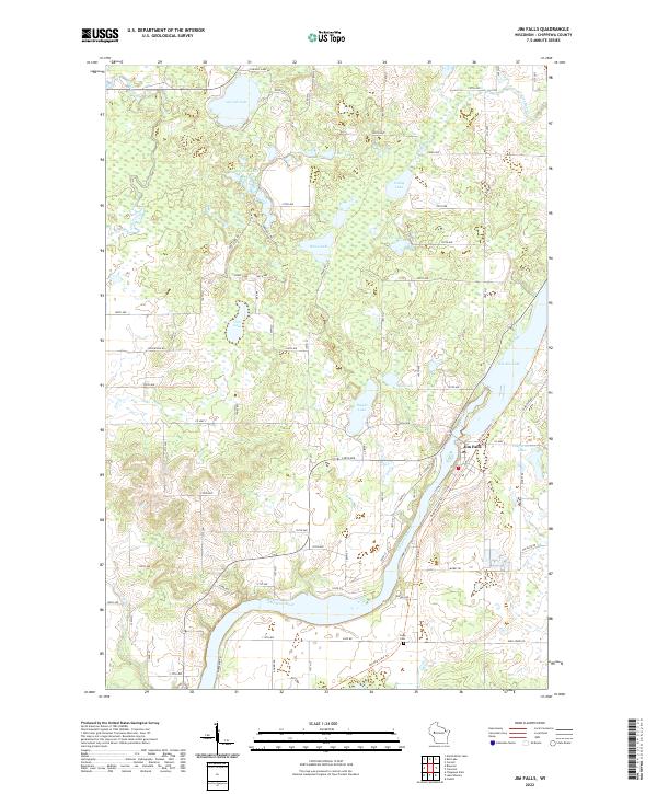
2022 Map of Jim Falls
USGS Topo · Published 2022About this map
Jim Falls sits at a strategic bend in the Chippewa River, where the waterway transitions from the open expanse of Old Abe Lake into a more confined channel. The surrounding landscape of Chippewa County is defined by a dense concentration of glacial kettle lakes, including the sizeable Cornell Lake, Popple Lake, and the centrally located Howe Lake. These water bodies are connected by a network of rural routes like Cornell Lake Dr and Howe Rd, which follow the township and range lines established by the Public Land Survey System.
Find a feature on this map
84 named features on this map. Tap any name to fly to it.
Don’t see what you’re looking for? This feature index may not catch every label — zoom into the map to look around manually.
Map Details
Editions of this 2022 Jim Falls Map
This is the sole edition of this map. No revisions or reprints were ever made.
Other maps of this area

1934 · Chippewa Falls
USGS Topo · 1:62,500

1936 · Chippewa Falls
USGS Topo · 1:62,500

1949 · Bloomer
USGS Topo · 1:62,500

1951 · Bloomer
USGS Topo · 1:62,500

1951 · Cornell
USGS Topo · 1:62,500

1952 · Cadott
USGS Topo · 1:62,500

1953 · Eau Claire
USGS Topo · 1:250,000

1953 · Rice Lake
USGS Topo · 1:250,000

1958 · Eau Claire
USGS Topo · 1:250,000

1959 · Rice Lake
USGS Topo · 1:250,000