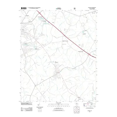
2011 Map of Joanna
USGS Topo · Published 2011About this map
Joanna serves as a central hub in this Upstate South Carolina landscape, situated along the Bush River at the intersection of several regional thoroughfares. The map details a transition from the eastern edge of Clinton toward more dispersed rural settlements like Kinards and Renno. The geography is defined by a network of drainage basins, including Indian Creek, Shell Creek, and the South Fork Duncan Creek, which are punctuated by a series of water control structures such as the Heath Copeland Pond Dam and the Duncan Creek WCD Dam Number Seven.
Find a feature on this map
90 named features on this map. Tap any name to fly to it.
Don’t see what you’re looking for? This feature index may not catch every label — zoom into the map to look around manually.
Map Details
Editions of this 2011 Joanna Map
This is the sole edition of this map. No revisions or reprints were ever made.
Other maps of this area

1941 · Spartanburg
USGS Topo · 1:250,000

1953 · Spartanburg
USGS Topo · 1:250,000

1960 · Spartanburg
USGS Topo · 1:250,000

1963 · Spartanburg
USGS Topo · 1:250,000

1964 · Spartanburg
USGS Topo · 1:250,000

1969 · Ora
USGS Topo · 1:24,000

1969 · Newberry NW
USGS Topo · 1:24,000

1969 · Sedalia
USGS Topo · 1:24,000
1969 · Philson Crossroads
USGS Topo · 1:24,000

1969 · Newberry West
USGS Topo · 1:24,000