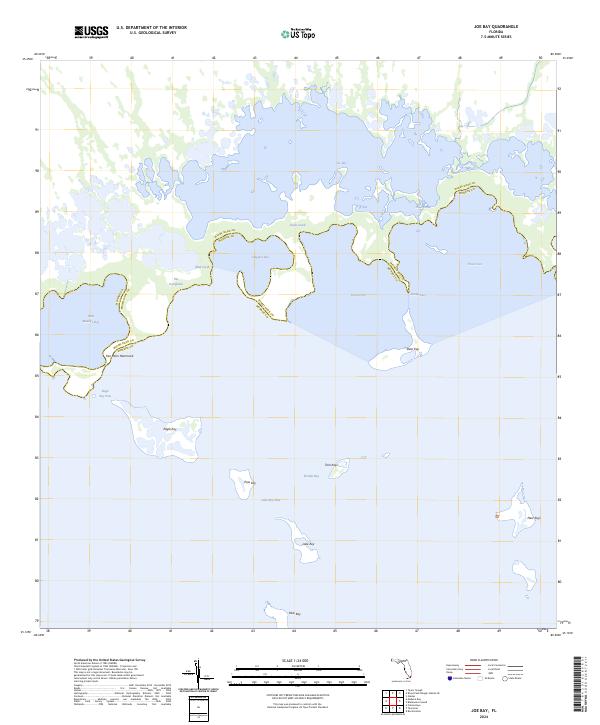
2024 Map of Joe Bay
USGS Topo · Published 2024About this map
Marjory Stoneman Douglas Wilderness and the southern reaches of The Everglades define this coastal landscape where the mainland dissolves into the intricate mangroves of Florida Bay. The shoreline is marked by a complex network of brackish waterways, including Joe Bay, Trout Creek, and Davis Creek, which serve as vital ecological arteries. These coastal features illustrate the transition from freshwater sloughs to saltwater estuaries, a characteristically fluid boundary line between Miami-Dade and Monroe counties.
Find a feature on this map
23 named features on this map. Tap any name to fly to it.
Don’t see what you’re looking for? This feature index may not catch every label — zoom into the map to look around manually.
Map Details
Editions of this 2024 Joe Bay Map
This is the sole edition of this map. No revisions or reprints were ever made.
Other maps of this area

1947 · Rock Harbor
USGS Topo · 1:24,000

1947 · Blackwater Sound
USGS Topo · 1:24,000

1949 · Blackwater Sound
USGS Topo · 1:24,000

1949 · Rock Harbor
USGS Topo · 1:24,000

1950 · Glades
USGS Topo · 1:24,000

1956 · Glades
USGS Topo · 1:24,000

1956 · Royal Palm Ranger Station SE
USGS Topo · 1:24,000

1956 · Miami
USGS Topo · 1:250,000

1958 · Miami
USGS Topo · 1:250,000

1967 · Royal Palm Ranger Station SE
USGS Topo · 1:24,000