
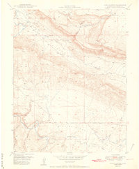
1950 Map of Joe Davis Hill
USGS Topo · Published 1950About this map
Dolores River carves a deep, winding course through this canyon landscape, defining the border between San Miguel and Dolores counties. This 1950 publication, produced in cooperation with the United States Atomic Energy Commission, reflects the intensive postwar exploration for mineral resources in the Colorado Plateau. The concentration of workings like the Norma Jean Mine, Sarah Ellen Mine, and Mucho Grande Mine around Joe Davis Hill points to a busy era of prospecting. In the high ground, Spud Patch Camp and various water sources such as Quakie Spring and Bell Canyon Reservoir supported the local mining and ranching economy. The map also delineates the northern reaches of the San Juan National Forest as it meets the Uncompahgre National Forest near Chico Creek.
Find a feature on this map
28 named features on this map. Tap any name to fly to it.
Don’t see what you’re looking for? This feature index may not catch every label — zoom into the map to look around manually.
Map Details
Editions of this 1950 Joe Davis Hill Map
2 editions found

Other maps of this area

1916 · Paradox Valley
USGS Topo · 1:125,000

1922 · Paradox Valley
USGS Topo · 1:125,000

1948 · Horse Range Mesa
USGS Topo · 1:24,000

1948 · Hamm Canyon
USGS Topo · 1:24,000

1948 · Gypsum Gap
USGS Topo · 1:24,000

1949 · Gypsum Gap
USGS Topo · 1:24,000

1949 · Egnar
USGS Topo · 1:24,000

1949 · Joe Davis Hill
USGS Topo · 1:24,000

1950 · Horse Range Mesa
USGS Topo · 1:24,000
1950 · Hamm Canyon
USGS Topo · 1:24,000