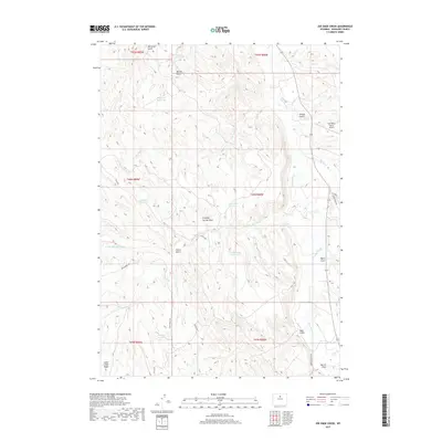
2017 Map of Joe Emge Creek
USGS Topo · Published 2017About this map
The Nowood River meanders through this portion of Washakie County, defining a landscape shaped by drainage systems and water management. This high-plains terrain is marked by numerous small-scale water storage projects, including Last Hope Reservoir, Flagstone Reservoir, and Warner Reservoir. These catchments, often located near draws and gulches such as McClellan Gulch and Chimney Springs Draw, reveal the vital role of water rights and ranching infrastructure in this arid region. Transportation is anchored by rural routes like Fiscus Rd and Buffalo Creek Rd, which provide access across the varied topography of Little Cedar Ridge. The presence of the Red Reflet Ranch Airport in the northeast corner highlights the intersection of modern private aviation with traditional Wyoming ranch lands, while numerous named drainages like Joe Emge Cr and Bud Kimball Cr map the intricate natural hydrology of the area.
Find a feature on this map
35 named features on this map. Tap any name to fly to it.
Don’t see what you’re looking for? This feature index may not catch every label — zoom into the map to look around manually.
Map Details
Editions of this 2017 Joe Emge Creek Map
This is the sole edition of this map. No revisions or reprints were ever made.
Other maps of this area

1899 · Cloud peak
USGS Topo · 1:125,000

1901 · Cloud Peak
USGS Topo · 1:125,000

1955 · Sheridan
USGS Topo · 1:250,000

1955 · Arminto
USGS Topo · 1:250,000

1958 · Sheridan
USGS Topo · 1:250,000

1958 · Arminto
USGS Topo · 1:250,000

1962 · Sheridan
USGS Topo · 1:250,000

1962 · Arminto
USGS Topo · 1:250,000

1966 · Big Trails
USGS Topo · 1:24,000

1966 · Big Trails NE
USGS Topo · 1:24,000