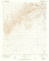
1967 Map of Johannesburg
USGS Topo · Published 1974About this map
Yellow Aster Mine and the surrounding industrial landscape dominate the northern slopes of the Rand Mountains, where mining operations left a distinct mark on the terrain by the late 1960s. The historic district of Randsburg and its neighbor Johannesburg sit at the desert's edge, characterized by a concentration of mine shafts, tailings, and the Fiddler Gulch drainage. To the south, the California City Corporate Boundary signals a mid-century shift toward large-scale planned residential development, though much of the area remained open desert at the time of this field check.
Find a feature on this map
21 named features on this map. Tap any name to fly to it.
Don’t see what you’re looking for? This feature index may not catch every label — zoom into the map to look around manually.
Map Details
Editions of this 1967 Johannesburg Map
2 editions found
Other maps of this area

1903 · Randsburg
USGS Topo · 1:62,500

1911 · Randsburg
USGS Topo · 1:62,500

1912 · Randsburg
USGS Topo · 1:62,500

1915 · Searles Lake
USGS Topo · 1:250,000

1943 · Saltdale
USGS Topo · 1:62,500

1943 · Castle Butte
USGS Topo · 1:62,500

1947 · Castle Butte
USGS Topo · 1:50,000

1947 · Trona
USGS Topo · 1:250,000

1948 · Trona
USGS Topo · 1:250,000

1953 · Trona
USGS Topo · 1:250,000