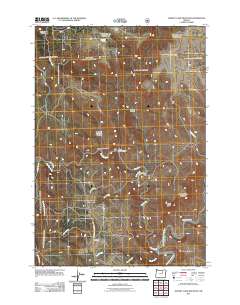
2011 Map of Johnny Cake Mountain
USGS Topo · Published 2011About this map
Johnny Cake Mountain stands as the central high point of this Morrow County landscape, where the rugged terrain of eastern Oregon is carved by a dense network of drainages. The small settlement of Top and the Top School mark the local community hubs along the Monument to County Line Rd. Water sources like Buckhorn Spring and named watercourses such as Big Wall Creek and Fern Creek define the geography, leading down toward the North Fork John Day River in the southeast corner. The map reveals an area defined by distinct topographical features with colorful names like Mulligan Stew Canyon, Black Rock Canyon, and Mahogany Flat. This 2011 survey illustrates the rural infrastructure of the region, anchored by the winding paths of County Rd 3 and Wall Cr Rd which navigate the complex canyon systems of the Blue Mountains province.
Find a feature on this map
30 named features on this map. Tap any name to fly to it.
Don’t see what you’re looking for? This feature index may not catch every label — zoom into the map to look around manually.
Map Details
Editions of this 2011 Johnny Cake Mountain Map
This is the sole edition of this map. No revisions or reprints were ever made.
Other maps of this area

1951 · Monument
USGS Topo · 1:62,500

1953 · Kimberly
USGS Topo · 1:62,500

1953 · Pendleton
USGS Topo · 1:250,000

1955 · Canyon City
USGS Topo · 1:250,000

1956 · Pendleton
USGS Topo · 1:250,000

1959 · Canyon City
USGS Topo · 1:250,000

1969 · Lake Penland
USGS Topo · 1:24,000

1969 · Madison Butte
USGS Topo · 1:24,000

1969 · Big Rock Flat
USGS Topo · 1:24,000

1980 · Monument
USGS Topo · 1:100,000